


Double-digit snowfall totals likely on some Colorado peaks before weekend hits
Weekend warriors, rejoice! It’s looking like many Colorado ski areas could get a nice refresh by the time the weekend hits.
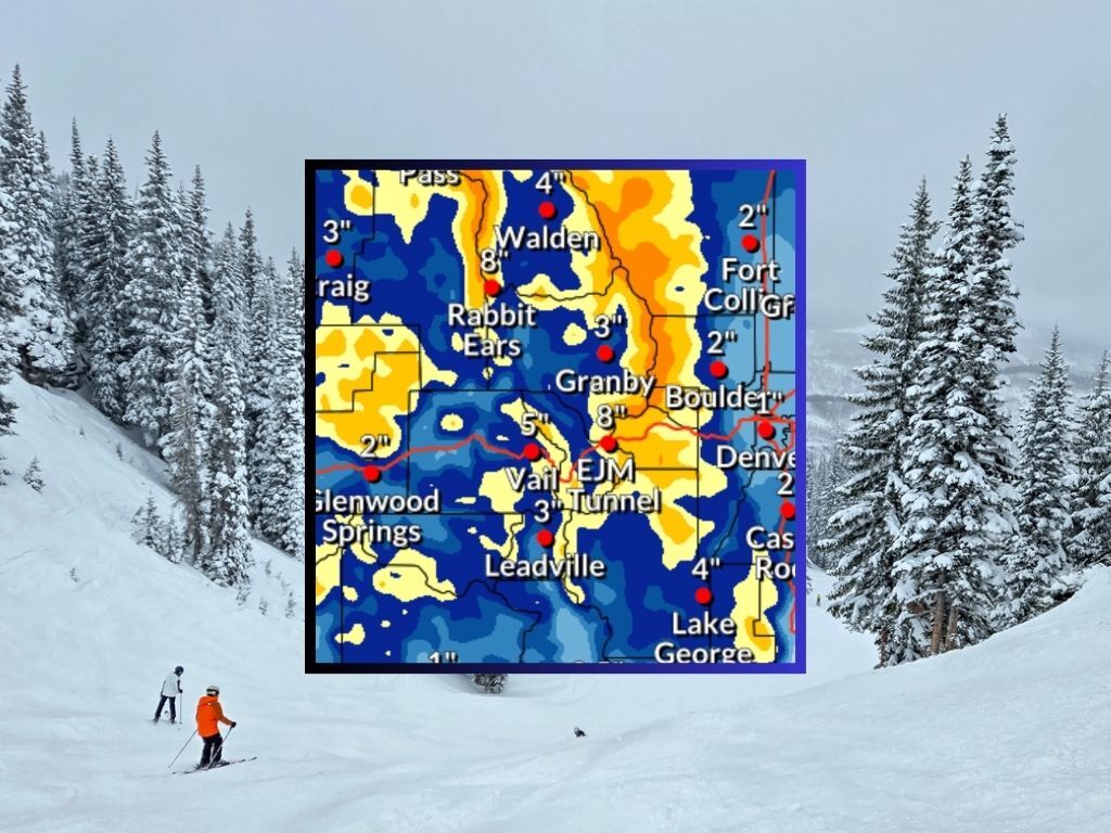
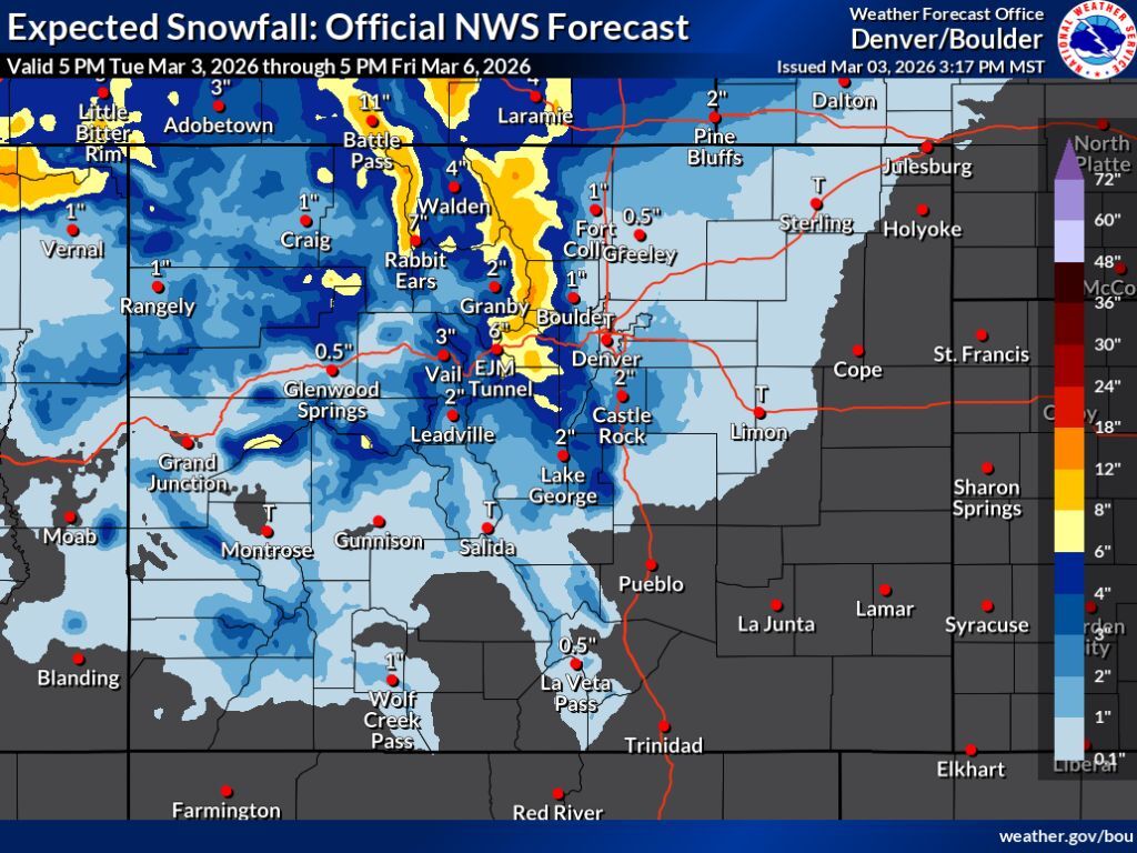
Mapping from the National Weather Service shows that in the most likely scenario, a winter storm will bring about 8 to 12 inches to peaks in the area of the Continental Divide north of I-70 through Friday at 5 p.m. The Park Range in the area of Steamboat Springs will likely get similar accumulation. There’s some snow expected in Summit County, as well.
See this snowfall forecast scenario depicted on the map below and keep scrolling for a look at the “high-end” scenario:
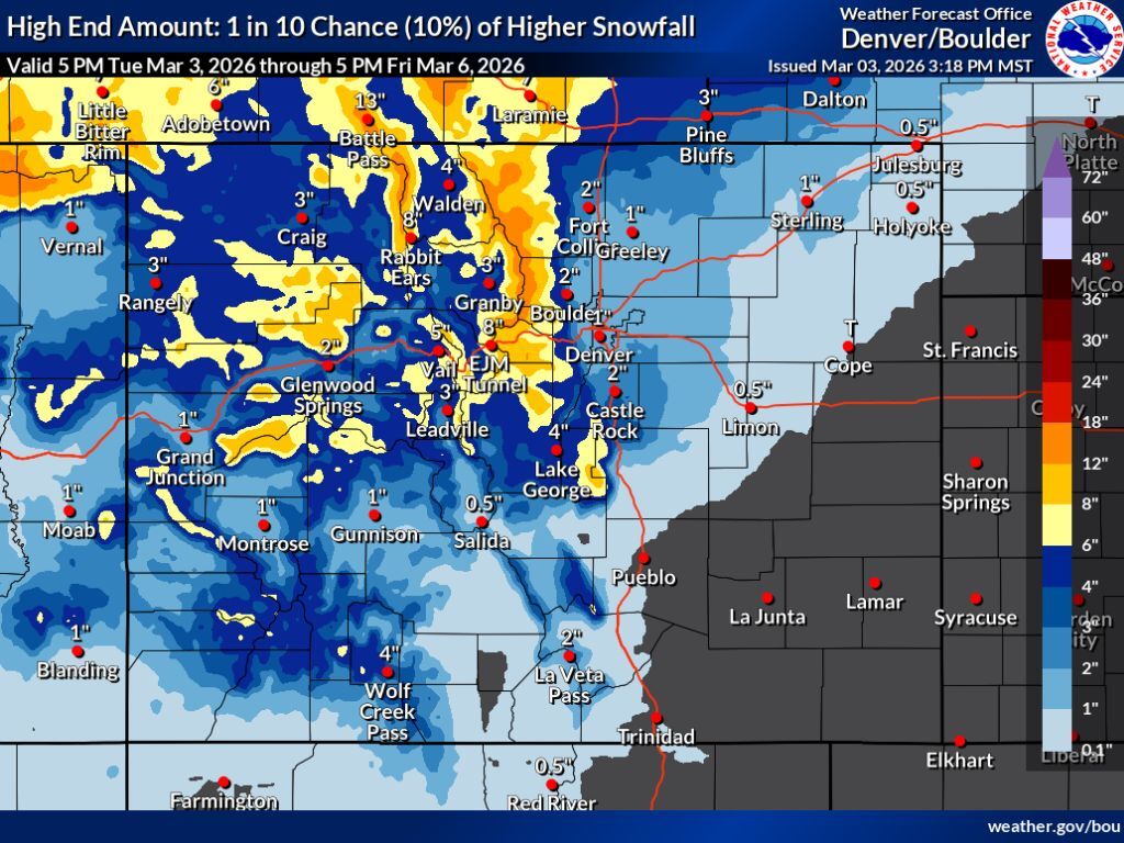
The National Weather Service also published mapping for a “high-end” scenario, which has a 10 percent chance of hitting but would come with greater impacts. In this scenario, totals could reach into the 12 to 18-inch range for peaks in previously noted areas, with the Flat Tops, peaks near Aspen, and those in Central Colorado having a shot at 6 to 12 inches, too. Pikes Peak could get about 6 to 12 inches in this scenario, as well.
See this scenario depicted below:
Per the OpenSnow five-day forecast, Echo Mountain gets the most snow over the next five days at about 14 inches. No where else gets more than a foot but most ski areas get at least 6 inches. Find a full resort-by-resort breakdown here.
According to the USDA, statewide snowpack is at 7.9 inches of snow-water equivalent as of March 3, which is about 61 percent of the norm and a record low for the date. On March 2, snow-water equivalent was at 8.0 inches, showing a decline over the past 24 hours.