


Double-digit snow totals expected in northern Colorado over upcoming days
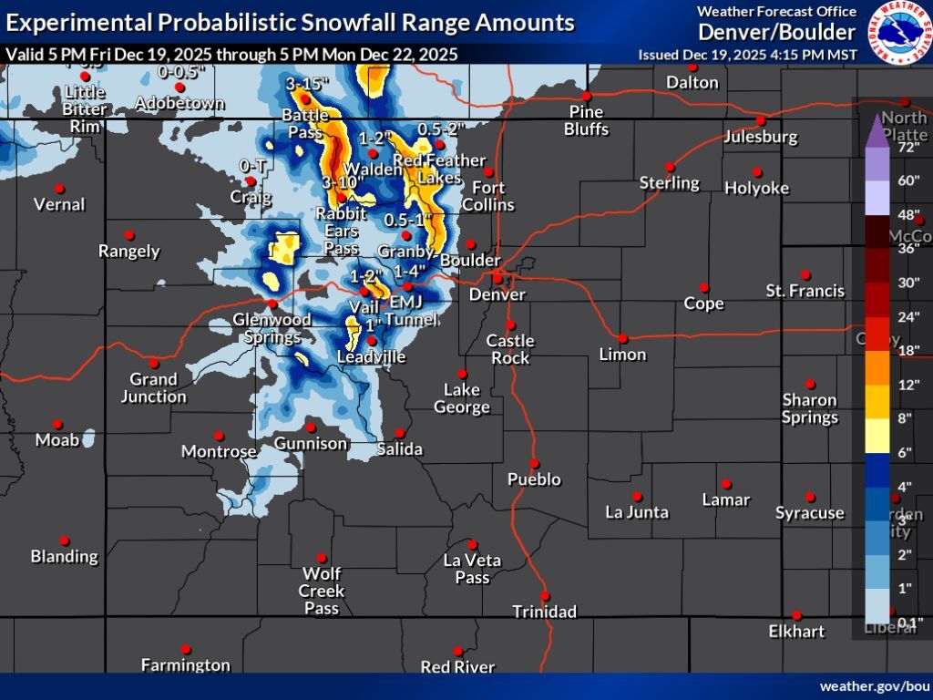
Following windy conditions on Friday, a decent amount of snow is expected to land in northern and central Colorado through Monday evening.
According to the National Weather Service, totals or about 18 to 24 inches could hit the Park Range found north of Steamboat Springs while the portion of the Continental Divide found north of I-70 could get snow in the range of eight to 18 inches. Vail Pass is expected to get similar totals to that of the Continental Divide, too, thus travel concerns along I-70 can be expected. Strong winds are also likely on-and-off throughout the weekend, which could limit visibility amid falling snow (see this forecast mapped on the feature image of the article, found above).
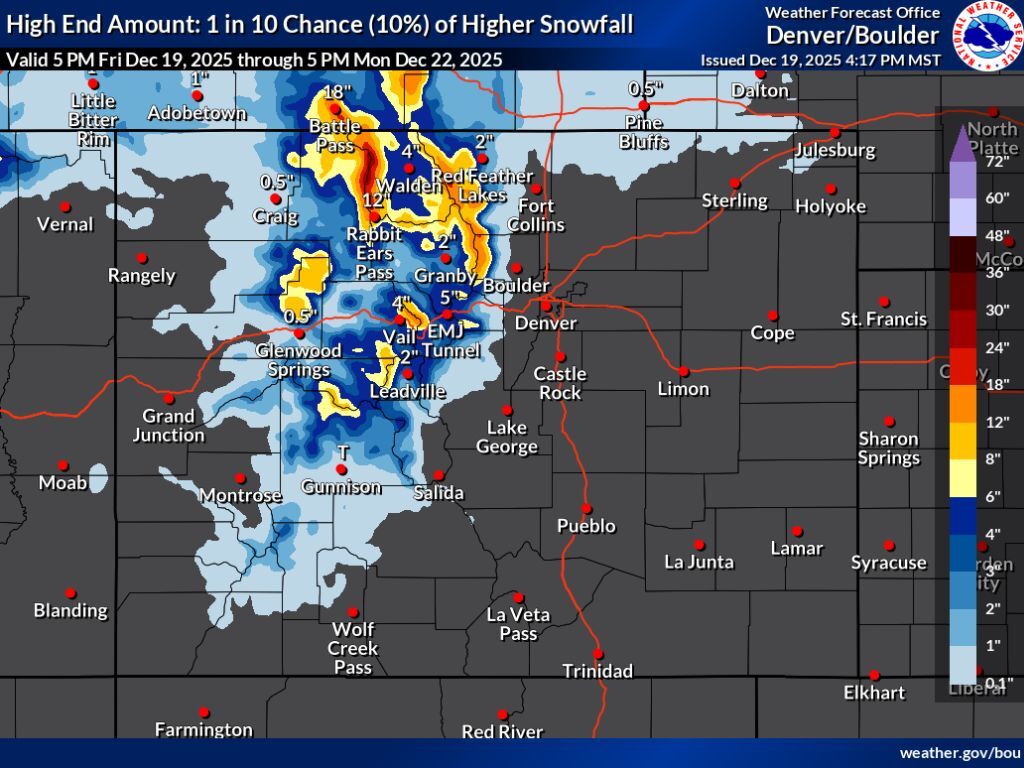
The ‘high-end’ snowfall scenario (10% chance) shows a similar region being impacted, though deeper totals could be a bit more widespread. In this high-end scenario, peaks south of I-70 also get quite a bit more snow compared to the most likely forecast.
Most of this snow should fall between Friday and Saturday night, with bigger storms possible at the tail-end of next week.
See this high-end scenario depicted on the map below:
While some pockets of Colorado could get some pretty significant snow over upcoming days, don’t expect much at the state’s ski resorts. Steamboat Resort should lead the pack over the next five days, according to OpenSnow, getting about six inches. Find the full OpenSnow report here.
Find additional forecasting information on the National Weather Service website.
STAY INFORMED: Get free Colorado news with our daily newsletter (Click here)
Get OutThere
Signup today for free and be the first to get notified on new updates.
PREV
PREVIOUS
Multiple highways shut down due to "safety concerns" amid 80+ MPH winds in Colorado
Winds reaching above 80 miles per hour have resulted in multiple major roads being closed in northern Colorado. The shut downs are due to safety concerns related to fire risk, flying debris, and low visibility amid blowing dust. RELATED: See a video of what these winds look like here Closures include: “Winds are contributing to […]
A skier's guide to Wolf Creek Ski Area: Terrain, dining, lodging, parking, and more
Wolf Creek Ski Area in southwest Colorado is celebrated as a hot spot for powder hounds, as it gets abundant snowfall and plenty of powder days – some say it even gets the most natural snow in Colorado each season (about 400 inches). The resort is also known for its in-bounds backcountry experience and chutes, […]