


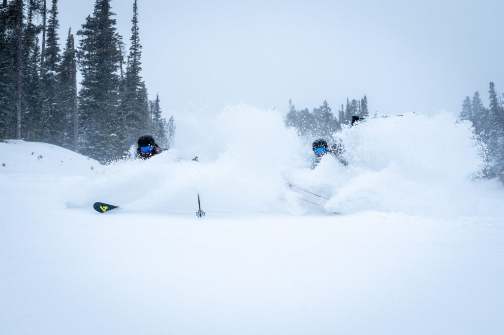
Newest ‘snow storm’ for Colorado to bring moderate totals: Whiteout daily snow report, April 30
Winter’s last stand comes in the form of moderate snow showers from Wednesday night to Friday.
Will skiers and riders at Colorado’s remaining open ski resorts get an early-May powder day?
Recap:
Some storm energy produced enough instability in the atmosphere over the Front Range mountains Monday to accumulate snow at Winter Park (1″). Highs were in the mid-40s with Winter Park recording a high of 45 according to Accuweather.
Forecast:
On Tuesday, temperatures around Colorado’s high country will bump up into the 50s, continuing the spring melt.
Colorado’s state-wide snowpack average on Tuesday is back above 85% to 87% after the latest snow event to close out April. Snow water equivalent is at 11.7 inches or 1.6 inches below the median of 13.3 inches.


Colorado’s median snowpack is at 87% of average on April 30, 2024. The black line indicates the current year.
On Wednesday day, temperatures will be in the 50s once again ahead of a disturbance drifting eastward across Wyoming.
Starting Wednesday night, this storm energy will push into northern and central Colorado, bringing moderate snow with it, mainly above 10,000 feet. The sagging low pressure system will carve into Utah before pushing its way into Colorado.


A Weather.us forecast map from the ECMWF model shows the synoptic composite of wind speeds, atmospheric pressure and humidity levels of the air for 10 p.m., Wednesday, May 1, for the United States. The reds, yellows and oranges represent moister air and the greens, blues and purples represent less moist air.
Most weather models have the heaviest snow accumulations staying north of Interstate 70 and west of the Continental Divide, with totals by Thursday’s first chairs between 4-8 inches, with up to 12 inches around Rocky Mountain National Park, Cameron Pass and the Park Range.


A Weather.us forecast map from the ECMWF model shows the potential total accumulation levels of water-equivalent precipitation as of 10 a.m., Thursday, May 2, for Colorado. Depending on the density of the snow, one inch of water is equivalent to 10 inches of snow based on a common rule of thumb ratio of 10:1.
Snow showers are forecast to continue into Friday with an additional 1-2 inches of snow, but more than likely won’t amount to a second spring-powder day.
Long Range:
Rain and snow showers are forecast to appear Saturday and Sunday with more sun than showers on Sunday.
On Monday, the potential for more snow exists again, mostly in the northern and northwestern mountains. Backcountry skiing and riding around the Park Range and Cameron Pass would be the best bet to enjoy this storm’s snows since Steamboat is closed, however, some snows could work their way south enough to hit Winter Park, Loveland and Arapahoe Basin.
More details about this potential snow event will come later in the week.


A map of the 8-14 day temperature outlook for the United States from May 7-13, 2024, shows above average temperatures for roughly 40% of the nation, with Colorado’s mountainous regions 33%-40% above average.
From May 7-13, the National Oceanic and Atmospheric Administration’s 8-14 day temperature outlook forecasts nearly all of Colorado’s mountainous regions to experience above normal average temperatures of between 40%-50%.
Today’s 24 hour snow totals from Colorado resorts:
Arapahoe Basin – 0″
Breckenridge – 0″ (Parts of Peak 8, plus Peaks 9 and 10 closed)
Copper Mountain – 0″
Loveland – 0″
Winter Park – 1″
Aspen Highlands – Closed for season
Aspen Mountain – Closed for season
Beaver Creek – Closed for season
Buttermilk – Closed for season
Cooper – Closed for season
Crested Butte – Closed for season
Echo Mountain – Closed for season
Eldora Mountain – Closed for season
Granby Ranch – Closed for season
Hesperus – Closed for season
Howelsen Hill – Closed for season
Kendall Mountain – Closed for season
Keystone – Closed for season
Monarch – Closed for season
Powderhorn – Closed for season
Purgatory – Closed for season
Silverton – Closed for season
Snowmass – Closed for season
Steamboat – Closed for season
Sunlight – Closed for season
Telluride – Closed for season
Vail – Closed for season
Wolf Creek – Closed for season
Large weekend storm drops 33″ of snow at one Colorado spot, snowpack doubles over 7 day stretch
Jonathan Ingraham
jonathan.ingraham@denvergazette.com
Updated 1 minute ago
The first big snow storm of winter 2025-26 for Colorado dropped about 10-20 inches in the northern mountains, 8-14 inches in the central mountains and 3-8 inches in the southern mountains. Colorado’s snowpack doubled in both median average and snow...
Jonathan Ingraham
Reporter
Denver weather: More melting on Monday as temperatures climb
Jonathan Ingraham
jonathan.ingraham@denvergazette.com
Updated 9 minutes ago
Melting snow will continue Monday across metro Denver as the sun is forecast to come out in full as temperatures push into the 50s today. Denverites can expect sunny skies, with a high near 53 today, according to the National...
Jonathan Ingraham
Reporter

EDITORIAL: Another sign wolf reintroduction needs to halt
The Gazette Editorial Board
thegazette-editorial-board@gazette.com
Updated 3 days ago
Five years after Coloradans voted by a razor-thin margin to reintroduce wolves to Colorado, they are right to look at the job state officials and agencies have done and ponder whether this a dog that just doesn’t hunt. Amid criticism...
The Gazette Editorial Board
Reporter

Ag industry can’t surrender the keys to the Kingdom
Rachel Gabel
rachel-gabel@denvergazette.com
Updated 3 days ago
Animal agriculture, ranching, hunting, and farming are not dying ways of life. The cowboy is not about to ride off into the sunset and certain extinction. Beef is not going to be replaced by cultured meat, any variety of bugs,...
Rachel Gabel
Reporter
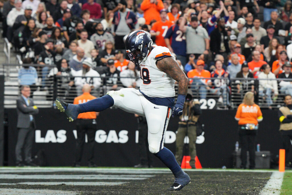
Denver Broncos ready to ‘test our stuff’ as schedule toughens after 10th straight win
Chris Tomasson
chris.tomasson@gazette.com
Updated 6 hours ago
LAS VEGAS – During their 10-game winning streak, the Broncos have fattened up against some losing foes. The schedule, though, is about to change. The Broncos (11-2) next Sunday will face Green Bay (9-3-1) at home in a battle of...
Chris Tomasson
Reporter
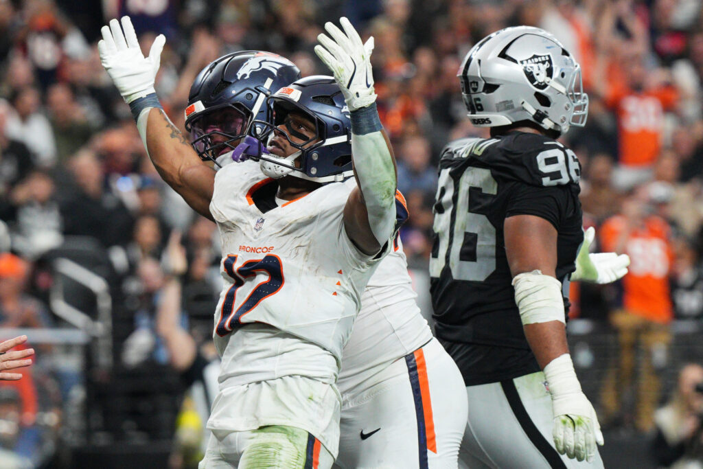
Broncos’ Harvey steals spotlight from first-round pick Jeanty in Week 14 win
Kyle Fredrickson
kyle-fredrickson@denvergazette.com
Updated 8 hours ago
LAS VEGAS — RJ Harvey stole the show from Ashton Jeanty. The Broncos defeated the Raiders, 24-17, on Sunday at Allegiant Stadium in a clash of rookie running backs. Las Vegas selected Jeanty at No. 6 overall (first round) out of Boise State. Denver picked Harvey at No....
Kyle Fredrickson
Reporter

Mark Kiszla: How Bo Nix has become the Wayne Newton of NFL QBs, singing all the hits he knows by heart
Mark Kiszla
mark-kiszla@denvergazette.com
Updated 10 hours ago
LAS VEGAS – Paying tribute to Mr. Las Vegas, Broncos quarterback Bo Nix followed the tried-and-true showbiz rule of Wayne Newton. When bringing your act to the bright lights of the Strip, the audience demands you play the greatest hits....
Mark Kiszla
Reporter

Sparked by Marvin Mims’ first career punt return for TD, Broncos roll to 24-17 win over Raiders
Chris Tomasson
chris.tomasson@gazette.com
Updated 10 hours ago
LAS VEGAS – The Broncos are winning big these days, so it was only appropriate Marvin Mims Jr. did the Mile High Salute on Sunday. The wide receiver did so after his 48-yard punt return for a touchdown in the...
Chris Tomasson
Reporter
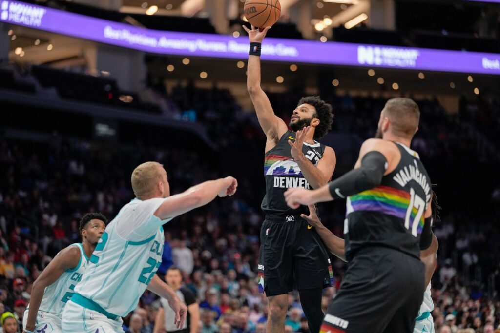
Nikola Jokic passes Michael Jordan on NBA’s assists list as Nuggets add 10th straight road win | 3 takeaways
Vinny Benedetto
vinny-benedetto@denvergazette.com
Updated 9 hours ago
The Nuggets probably were buzzing on the flight back from Charlotte after extending the franchise-record road winning streak to 10 games. Here are three takeaways from Denver’s 115-106 win over the Hornets on Sunday at Spectrum Center: 1. For a...
Vinny Benedetto
Reporter

Broncos WR Marvin Mims returns punt for ‘clutch’ touchdown in road win over Raiders
Kyle Fredrickson
kyle-fredrickson@denvergazette.com
Updated 9 hours ago
LAS VEGAS — A buzz started growing on the Broncos’ sideline when Marvin Mims dropped back to return a punt against the Raiders. “We talked about it: Marvin is going to break through and score him a touchdown,” cornerback Patrick...
Kyle Fredrickson
Reporter