


‘Heavy snow’ inbound for Colorado during 10-day stormy period

Courtesy, JP Douvalakis, Breckenridge Ski Resort
Snow returns to Colorado’s high country for the second weekend of February and the potential for 4-10 inches up north and 2-4 inches in the middle are high.
Arctic air mixing with good moisture levels early to mid next week will continue to pile snow up in the mountains, hopeful skiers and riders will delight in building back up the dismal snowpack, especially in the southern mountains.
A prolonged stormy pattern developing from Valentine’s Day Friday to President’s Day Monday is becoming more clear as well.
Recap:
Unfortunately, the quick shot of snow forecast for Wednesday didn’t really deliver much of anything to Colorado’s high country except high-level clouds passing by. Not even Steamboat received any snow.
On Thursday, skies cleared over much of Colorado ahead of a storm system moving onshore in northern California.


A satellite image of the northern Rockies 1142 a.m., Feb. 6, 2025.
Temperatures around the ski areas and resorts were cooler with the National Weather Service in Boulder recording a high of 40 degrees at Copper Mountain, the NWS office in Grand Junction recording a high of 33 degrees at Aspen Highlands, and 37 degrees at Telluride.
Forecast:
On Friday, snow develops in the northern mountains after sunset and should pick up in intensity into overnight Saturday, making first chairs rather soft at ski areas and resorts north of Interstate 70.
Snow continues on Saturday, but is not as heavy during the day, yet it should ramp back up Saturday night through Sunday mid-morning.
Snowfall totals for Saturday morning are forecast to be between 4-10 inches in the northern mountains, 2-4 inches in the central mountains (mainly in Pitkin and Gunnison counties), and maybe a dusting in the northern San Juans if any snow falls at all.


An ECMWF Total snowfall, Kuhera (in) forecast map of Colorado from 11 a.m., Thursday, Feb. 6 to 8 a.m., Saturday, Feb. 8, 2025.
The European model is forecasting more conservative snowfall totals across the state than the GFS and NWS Blend of Model models.
The GFS model shows noticeably more snow accumulations in the central mountains and around Eagle County (think 1.5 times as much snow), and the NWS Blend shows more snow along the Continental Divide west of Boulder, in the Elks around Aspen and in Eagle, Summit and southern Grand County (about 1.5 times as much snow as well).
Snowstorm grand totals by Sunday late morning are forecast to be between 8-12 inches in the northern mountains, between 6-10 inches in the central mountains, and between 1-3 inches in the northern side of the southern mountains.
The ECMWF:


An ECMWF Total snowfall, Kuchera (in) forecast map of Colorado from 11 a.m., Thursday, Feb. 6 to 11 a.m., Sunday, Feb. 9, 2025.
The GFS:


A GFS Total snowfall, Kuchera (in) forecast map of Colorado from 11 a.m., Thursday, Feb. 6 to 11 a.m., Sunday, Feb. 9, 2025.
The NWS Blend of Models:


A NWS Blend of Models Total snowfall, Model Ratio (in) forecast map of Colorado from 12 p.m., Thursday, Feb. 6 to 11 a.m., Sunday, Feb. 9, 2025.
Monday is trending toward sunny-ish in the morning, cloudy early afternoon, and snow developing by late afternoon, but this time the southern mountains are forecast to receive some snow.
Colorado’s Snowpack:
Two weeks ago, Colorado’s snowpack was at 89% of median average. One week ago, it was at 85%, but then some snow came in and pushed that percentage toward 90%.


Colorado’s median snowpack is at 84% of average on Feb. 6, 2025.
However, a fast melt has been on since Feb. 3 and it currently is at 84% of the median average, with 8.5 inches of snow water equivalent locked up in the snow.
Long-term forecast:
Monday afternoon/evening snow is forecast to spread across the southern half of the state first via west winds for a quick shot of snow.
By Tuesday morning storm energy will have shifted back to focusing on the northern and central mountains as continued west-to-east zonal flow occurs.
While moisture and westerly winds funnel snow into Colorado, Arctic air will begin creeping southward into northeastern Colorado on Tuesday.
For Tuesday, Wednesday, and Thursday morning, snow will continue to fall across all three mountain zones.
However, the Arctic airmass pushing southward from Wyoming will create very rather cold days both on Tuesday and Wednesday, with sub-zero temperatures Tuesday and Wednesday night; Thursday morning could see the coldest temperatures of February.


An ECMWF 2 m AGL Temperature (F) forecast map of Colorado at 5 a.m., Thursday, Feb. 13, 2025.
Friday, Saturday, Feb. 15, and Sunday, Feb. 16 are trending toward the potential for a prolonged snow-storm event, with noticeable snowfall across all three mountain zones again.
Not all the models are in agreement yet with this forecast, but the chances are trending upward that at least moderate amounts will fall.
Today’s (Feb. 8) 24-hour snow totals from Colorado resorts:
Arapahoe Basin – 6″
Aspen Highlands – 4″
Aspen Mountain – 2″
Beaver Creek – 6″
Breckenridge – 6″
Buttermilk – 1″
Cooper – 5″
Copper Mountain – 4″
Crested Butte – 0″
Echo Mountain – 1″, plus tubing
Eldora Mountain – 3″
Granby Ranch – 3″
Hesperus – Closed for the season
Howelsen Hill – 5″
Kendall Mountain – 0″
Keystone – 7″
Loveland – 4″
Monarch – 0″
Powderhorn – 1″
Purgatory – 0″
Silverton – 0″
Snowmass – 2″
Steamboat – 10″
Sunlight – 2″
Telluride – 0″
Vail – 9″
Winter Park – 5″
Wolf Creek – 0″
(Contact Denver Gazette digital producer Jonathan Ingraham at jonathan.ingraham@denvergazette.com or on X at @Skingraham and Instagram at @Skingraham311.)
We need more affordable housing in existing neighborhoods
Jill Gaebler
jgaebler@cscedc.com
Updated 4 days ago
By Jill Gaebler Special to the Gazette Colorado Springs is growing. That is not news and is not debatable. We live in a beautiful region, adjacent to the easternmost 14er, our own Pikes Peak, which has drawn settlers here for...
Jill Gaebler
Reporter
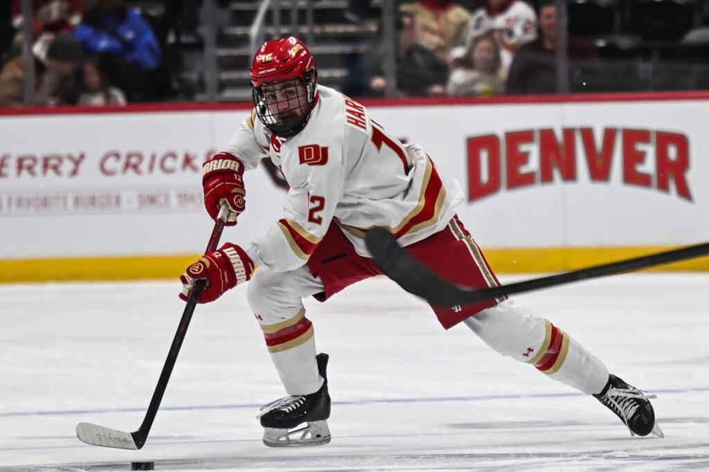
No. 6 Denver hockey sweeps No. 19 Miami (Ohio), retains NCHC lead
Tyler King
tyler-king@denvergazette.com
Updated 4 hours ago
David Carle’s team knows how to bounce back. After suffering an overtime loss in a thrilling game against Minnesota last Saturday at Ball Arena, No. 6 Denver (11-5-1, 7-1-0 NCHC) rebounded with a weekend sweep over No. 19 Miami (Ohio)...
Tyler King
Reporter
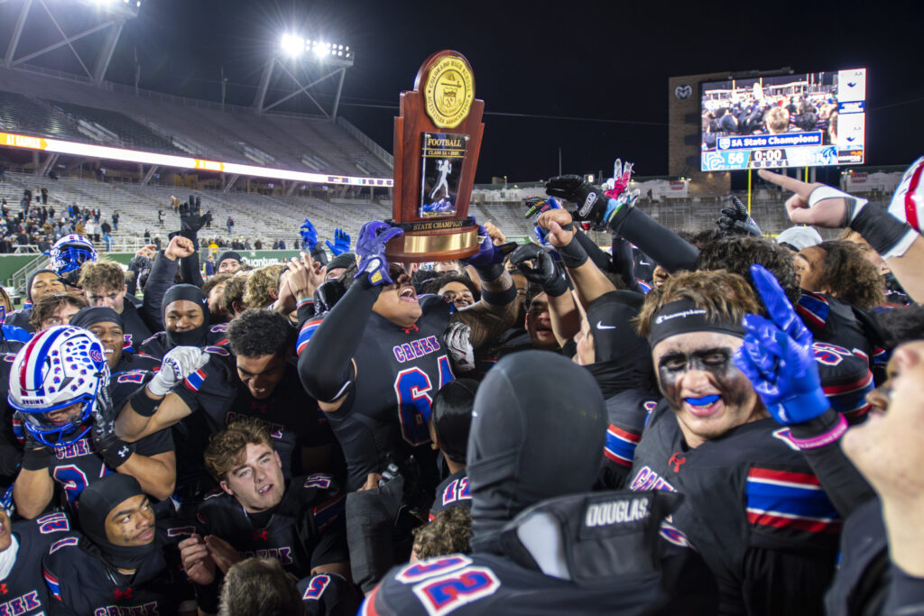
Loaded Cherry Creek surges past Ralson Valley for 5th title in 6 years
Brent Briggeman
brent-briggeman@denvergazette.com
Updated 4 hours ago
FORT COLLINS – The cherry was neatly placed on top. Again. Capping a week when many on Cherry Creek’s loaded roster signed with colleges and a season of dominant perfection, the Bruins handled Ralston Valley 56-28 in the 5A state...
Brent Briggeman
Reporter

Family traditions highlight annual Parade of Lights in downtown Denver
Noah Festenstein
noah-festenstein@denvergazette.com
Updated 4 hours ago
Thousands of spectators cheered as giant balloon characters and floats decorated with holiday lights paraded through downtown Denver on Saturday night. For many, though, it wasn’t just about watching the 51st annual 9NEWS Parade of Lights. Rather, it’s about celebrating...
Noah Festenstein
Reporter
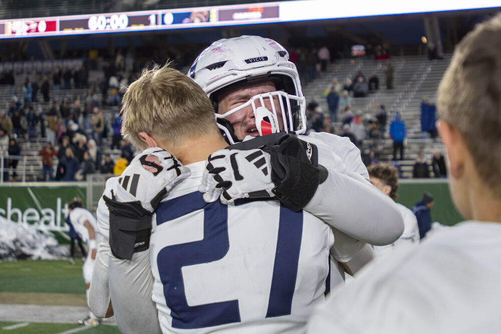
Palmer Ridge loses to Dakota Ridge in title game, first loss of the season
Marcus Hill
marcus.hill@gazette.com
Updated 3 hours ago
FORT COLLINS – Palmer Ridge hoped the tears left behind at Canvas Stadium would be those of joy. They were not. As the final horn sounded, Dakota Ridge, 4A’s No. 1 seed, bolted to the sideline to celebrate with teammates,...
Marcus Hill
Reporter
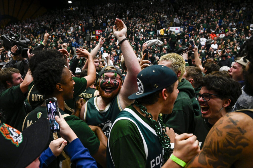
Hot-shooting Colorado State holds on for thrilling win over rival Colorado
Tyler King
tyler-king@denvergazette.com
Updated 7 hours ago
FORT COLLINS — Score one for the Colorado State math department and professor Ali Farokhmanesh. Just about every statistic suggested Colorado should have won Saturday afternoon. The previously unbeaten Buffaloes (8-1) were the more physical team, dominating in the paint....
Tyler King
Reporter
Dakota Ridge’s hot start puts Palmer Ridge in quick 3-touchdown hole during 4A title game
Brent Briggeman
brent-briggeman@denvergazette.com
Updated 7 hours ago
FORT COLLINS – The opening minutes inside a pressure cooker can spit out some extreme results. Dakota Ridge and Palmer Ridge found themselves on opposite ends of that spectrum in Saturday’s 4A football championship game, which the top-seeded Eagles won,...
Brent Briggeman
Reporter

Clash of the titans: Democratic race for governor pits two candidates similar in focus, but very different in style | Vince Bzdek
Vince Bzdek
vince-bzdek@denvergazette.com
Updated 7 hours ago
By Vince Bzdek The race for governor is shaping up to be a clash of Democratic titans, U.S. Sen. Michael Bennet and Attorney General Phil Weiser. They are two of Colorado’s highest profile politicians with deep track records who...
Vince Bzdek
Reporter

Mark Kiszla: How to fix the nonsensical mess that is the college football playoffs
Mark Kiszla
mark-kiszla@denvergazette.com
Updated 4 hours ago
On the dumbest day of the entire college football season, the legendary Nick Saban and Georgia coach Kirby Smart said something really intelligent. “It’s all B.S.,” Smart told Saban, during a spicy interview that aired Saturday on ESPN. I couldn’t agree...
Mark Kiszla
Reporter

Denver area events for Dec. 7
Carlotta Olson
carlotta-olson@denvergazette.com
Updated 8 hours ago
If you have an event taking place in the Denver area, email information to carlotta.olson@gazette.com at least two weeks in advance. All events are listed in the calendar on space availability. Sunday Latkes and Lights Hanukkah Celebration — 10 a.m.-1 p.m., JCC...
Carlotta Olson
Reporter