


Denver weather: More rain Thursday from monsoonal flow but drying out is coming

Favor_of_God
The wet weather pattern still has two to three more days left in it, starting Thursday, to bring moisture to metro Denver before a drying trend happens over the Labor Day weekend.
Denver residents can expect a 50% chance of showers and thunderstorms, mainly after 2 p.m., according to the National Weather Service in Boulder. It’ll be partly sunny, with a high near 80. Calm winds become east between 5 to 7 mph in the afternoon.
9News
Tonight there will be a chance of showers and thunderstorms before midnight, then a slight chance of showers between midnight and 3 a.m. Mostly cloudy, with a low around 59. East wind 5 to 7 mph becoming south southwest after midnight. Chance of precipitation is 40%.
Denver International Airport has recorded 1.42 inches of rain at the AWOS station since last Saturday while several other stations around metro Denver have now recorded between 0.4 (downtown Denver) to 0.9 (Ken Caryl) inches of rain.
Friday and Saturday show the most promise for additional rain.
Drying out begins Sunday and a return to more seasonal temperatures for the last couple of days of August.
Here’s the 4-day forecast from the National Weather Service.
Friday: A 40 percent chance of showers and thunderstorms after noon. Mostly sunny, with a high near 80. Calm wind becoming west northwest 5 to 7 mph in the afternoon.
Saturday: A slight chance of showers, then a chance of showers and thunderstorms after noon. Partly sunny, with a high near 78. Calm wind becoming north northeast around 6 mph in the morning. Chance of precipitation is 50%.
Sunday: Sunny, with a high near 80.
Labor Day: Sunny, with a high near 84.
(Contact Denver Gazette digital producer Jonathan Ingraham at jonathan.ingraham@denvergazette.com or on X at @Skingraham and Instagram at @Skingraham311.)
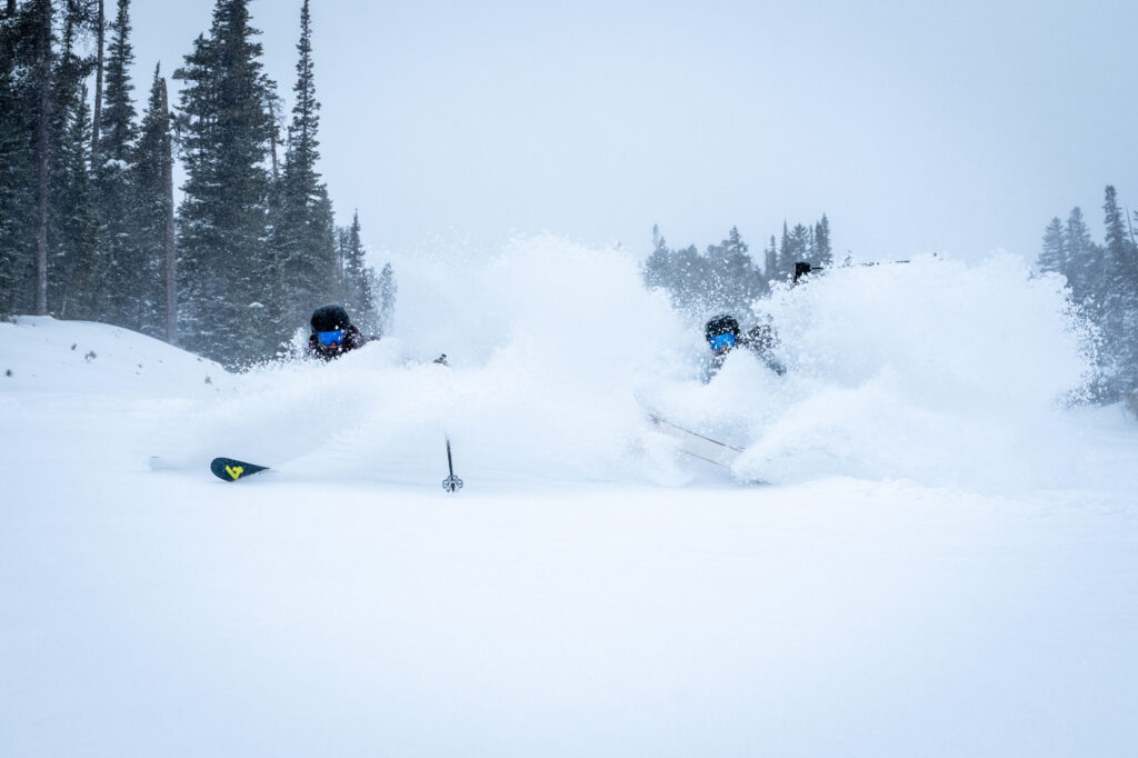
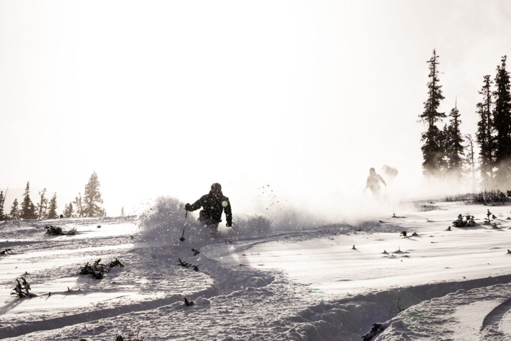
Large weekend storm drops 33″ of snow at one Colorado spot, snowpack doubles over 7 day stretch
Jonathan Ingraham
jonathan.ingraham@denvergazette.com
Updated 7 hours ago
The first big snow storm of winter 2025-26 for Colorado dropped about 10-20 inches in the northern mountains, 8-14 inches in the central mountains and 3-8 inches in the southern mountains. Colorado’s snowpack doubled in both median average and snow...
Jonathan Ingraham
Reporter
Denver weather: More melting on Monday as temperatures climb
Jonathan Ingraham
jonathan.ingraham@denvergazette.com
Updated 9 hours ago
Melting snow will continue Monday across metro Denver as the sun is forecast to come out in full as temperatures push into the 50s today. Denverites can expect sunny skies, with a high near 53 today, according to the National...
Jonathan Ingraham
Reporter
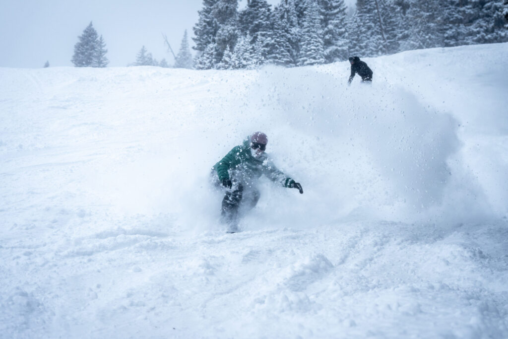
Heavy blast of snow forecast for Colorado as 2-3 feet could fall over next 2 days
Jonathan Ingraham
jonathan.ingraham@denvergazette.com
Updated 8 hours ago
Colorado’s high country is about to receive a big blast of snow over the next two days, with some northern locations possibly seeing between 24-36 inches of snow by Sunday morning. Travel impacts on the state’s northern highways could be...
Jonathan Ingraham
Reporter
Denver weather: Mostly sunny Friday leads to rainy start to weekend
Jonathan Ingraham
jonathan.ingraham@denvergazette.com
Updated 3 days ago
Metro Denver will get one more day of sunshine with some clouds on Friday before a potentially wet and/or snowy Saturday to close out the work week. Denver residents can expect mostly sunny skies, with a high near 40, according...
Jonathan Ingraham
Reporter
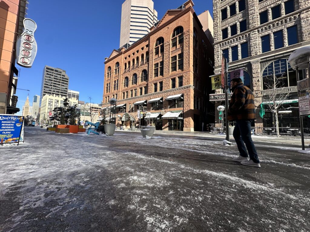
Icy and dicey: 16th Street less slippery now but not invincible
Bernadette Berdychowski
bernadette.berdychowski@denvergazette.com
Updated 4 days ago
The iconic diamondback-pattern pavers of 16th Street were more than just stone cold on Thursday morning – they were also slick with ice. In typical Colorado fashion, the shaded parts were dicier, while sections exposed to sunlight quickly dried following...
Bernadette Berdychowski
Reporter
Denver weather: Sunshine returns Thursday to help melt some of the snow
Jonathan Ingraham
jonathan.ingraham@denvergazette.com
Updated 4 days ago
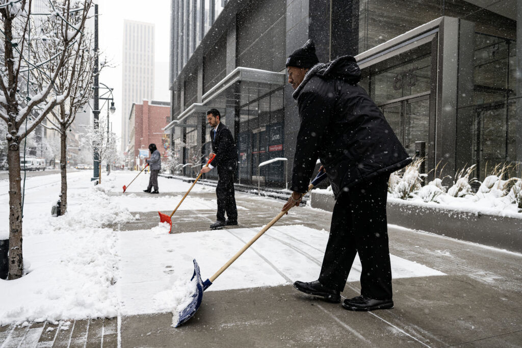
After several inches of snow fell across metro Denver on Wednesday, the sun returns Thursday with warmer temperatures to help melt some of the snow on road surfaces. But don’t expect much to truly melt, it won’t be that warm....
Jonathan Ingraham
Reporter
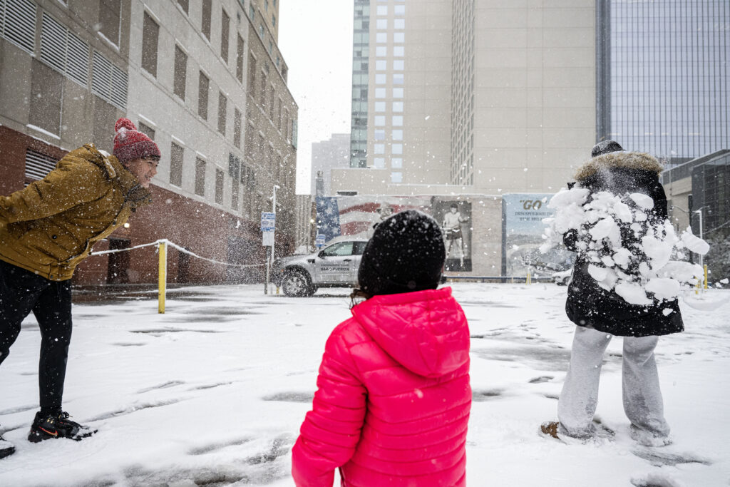
PHOTOS: Snow hits the Front Range
Stephen Swofford
stephen-swofford@denvergazette.com
Updated 5 days ago
Stephen Swofford
Reporter
Snow totals: Here’s how much fell across Colorado from December storm
Jonathan Ingraham
jonathan.ingraham@denvergazette.com
Updated 4 days ago
The first major snow storm of winter 2025-26 hit Denver and Front Range late Tuesday night, dropping several inches of snow from Pueblo to Cheyenne, Wyoming. The highest accumulations were in the Front Range foothills west of Denver and west...
Jonathan Ingraham
Reporter
Flights delayed, traffic slowed as Denver receives first major snow
Michael Braithwaite
michael.braithwaite@gazette.com
Updated 5 days ago
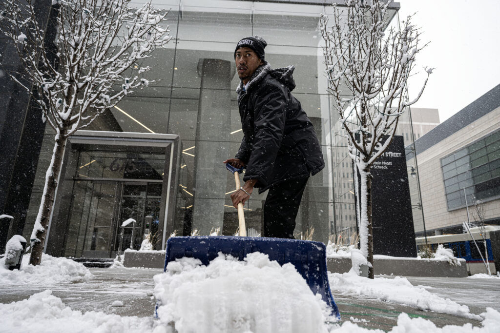
Denverites woke up to a winter wonderland, with over two inches of snow blanketing the city by rush hour Wednesday morning. That number was a low point along the Front Range, according to the National Weather Service Boulder. Fort Collins...
Michael Braithwaite
Reporter
10-20″ of snow forecast in Colorado from multi-day weekend storm
Jonathan Ingraham
jonathan.ingraham@denvergazette.com
Updated 4 days ago
Winter weather continues to bring a lot more snow to Colorado’s high country in December as a multi-day weekend storm packs between 8-16″ for some ski areas across the state. In all, 10-20″ of snow is possible by weekend’s end...
Jonathan Ingraham
Reporter
PREV
PREVIOUS

Denver weather: Three more days of rain starting Wednesday for Denver
Facebook Twitter WhatsApp SMS Email Print Copy article link Save Facebook Twitter WhatsApp SMS Email Print Copy article link Save Continued unsettled weather conditions on Wednesday will bring more rain to metro Denver as monsoonal flows stay locked in place. Denverites can expect showers and thunderstorms, mainly between 3 and 5 p.m., according to the […]

Denver weather: Less rain action Friday heading into Labor Day weekend
Facebook Twitter WhatsApp SMS Email Print Copy article link Save Facebook Twitter WhatsApp SMS Email Print Copy article link Save Metro Denver should see a lull in rain storm action Friday but still some precipitation is possible in the late afternoon and early evening. Denverites can expect a 30% chance of showers and thunderstorms after […]